Bridgend Council’s Cabinet is set to discuss an official report into flooding caused by an unnamed storm in September 2024 (pdf).
The full report – called a Section 19 report- is available here (pdf).
It comes after recent stories elsewhere in the press about ongoing flooding of the Nant Pontysanau directly next to the Caer Castell apartments at Longacres/Erw Hir in Brackla. The issue has also been raised at Senedd level by Altaf Hussain MS (Con, South Wales West).
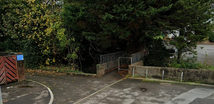
The flood investigation included Nant Pontysanau, but also flooding of the Nant Cefn Glas (pictured above) that occurred at the same time. This affected the Hafan-y-Bryn, Oaklands Road, Oaklands Drive and Park Court Road area (the area around the “dip” on Park Street/Bryntirion Hill in Bridgend).
Report Conclusions
- 56mm (around 2 inches) of rain fell during the storm according to a rain gauge near Brackla; this makes it “one of the more intense (rainfall levels) encountered in recent years”.
- The rainfall in the Bridgend (town) area during the storm was measurably higher than in the surrounding areas, such as the Vale of Glamorgan and Llynfi Valley.
- At least 34 properties were flooded across the two sites – 10 at Caer Castell and the remainder in and around Nant Cefn Glas.
- The main cause of the flooding was that the two streams were unable to cope with the amount of rain. While there was no evidence of any blockages of Nant Cefn Glas culverts, some debris was found in Nant Pontysanau, which was cleared following the storm.
- There’s no evidence of any issues downstream which would have contributed to the flooding in either the River Ogmore (Nant Cefn Glas) or the River Ewenny (Nant Pontysanau).
- There was no evidence of any issues with highway drainage or sewer networks that contributed to the flooding.
What happens next?
As both floods involved “ordinary watercourses”, Bridgend Council is the lead local flood authority.
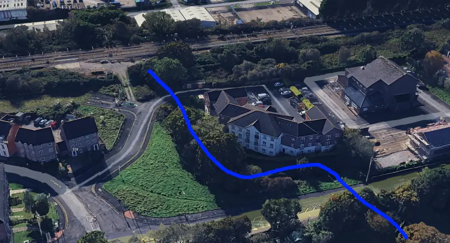
As has been raised in the press, the issue at Caer Castell is more complicated, as the Nant Pontysanau runs through a small culvert under the South Wales mainline, which is Network Rail’s land. The blue line below shows roughly where the Nant Pontysanau runs for those unfamiliar with it:
Bridgend Council has subsequently been awarded funding by the Welsh Government to address both streams.
£20,000 will go towards a flood bund around Caer Castell in Brackla. A further £105,000 has been made available to investigate and deliver flood protection/prevention improvements along the Nant Cefn Glas.
A separate Section 19 report is being prepared concerning the most recent flooding event in June 2025, which affected the same two locations as well as Aberkenfig, Maesteg, Garth and Nantyfyllon.